Hello,
Can someone help me understand the difference between Topography Colour by slope and Colour by height using Dynamo. I see in one of the blogs mentioning color by slope, Can someone help me with color by height. Thanks!
Hello,
Can someone help me understand the difference between Topography Colour by slope and Colour by height using Dynamo. I see in one of the blogs mentioning color by slope, Can someone help me with color by height. Thanks!
I don’t know these two nodes but i suppose the TopographyColor.BySlope node makes the color more red towards a bigger slope whilst the TopographyColor.ByHeight makes the color more red towards higher ground.
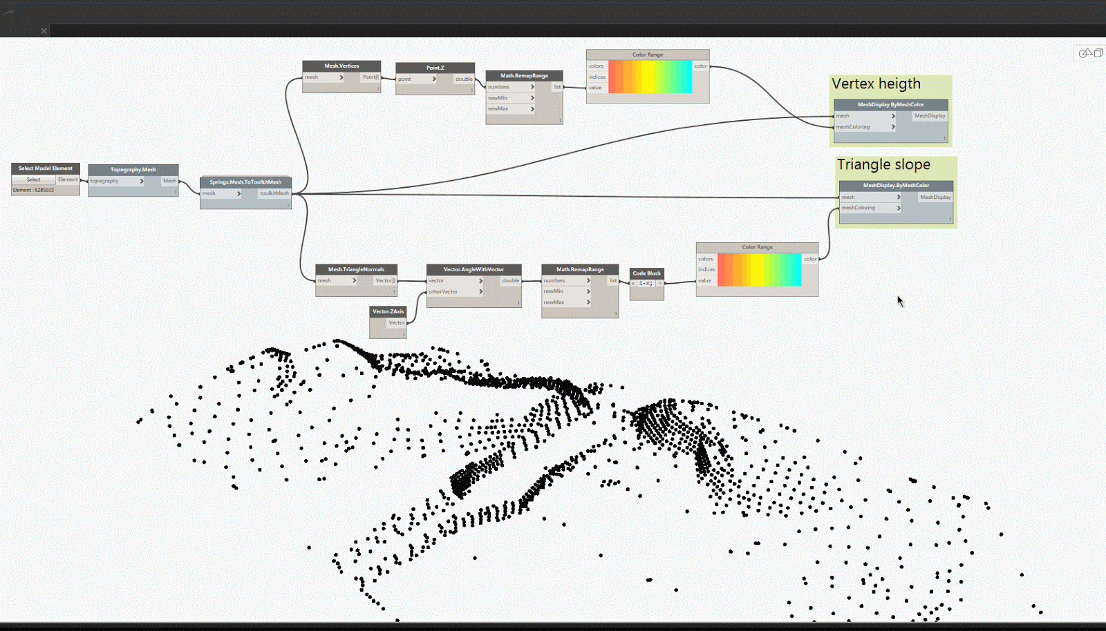
As far as I can tell the link you’ve provided shows a gif from an old blogpost I did. and @Daan is exactly right. The slope one is calculated by measuring the angle between each mesh face and Z-drection and remapping the angle to a value between 0 and 1 to get a matching color.
For the other one it is just the Z-value of each of the vertices mapped between 0 and 1. In my blogpost I use the MeshToolkit where the MeshDisplay.ByMeshColor have a bit of intelligence built in so that:
nr of colors = 1 –> [entire mesh single color]
nr of colors = nr of triangles –> [each triangle is colored the specified color]
nr of colors = nr of unique vertices –> [each triangle will interpolate between the color values at each vertex]
nr of colors = nr of non-unique vertices —> [each triangle will also interpolate between the color values across a face but may not blend between faces]
More info here: https://dynamobim.org/meshtoolkit-1-2-0-release-2/
and I haven’t heard about these Topography coloring nodes you talk about, are they new?
hi ! how could you export the meshdisplay.bymeshcolor to revit so you can get the heatmap to show on revit and not only dynamo? i couldnt do it so far…
