Please help me with my script (Toposurface and Excel-coordinates)

Hi,

I have problems with my script and wonder if anyone immiditaly sees the problem?
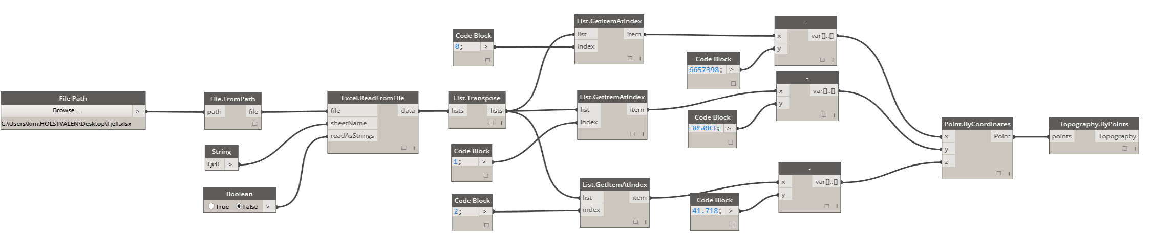
ExcelI have been given a kof-file from the arcitect and trying to create a toposurface for my project. I have until now never used Dynamo and it is probably why the script dosn’t work well.

I’ve tried to follow someone elses script and write the coordinates into an xslx-file. Still i’m just getting dots/points out.
If someone will bother to take a look at my script and the Excel-file I would be trurly greatful:D


1 Like

To use a points file section:

http://help.autodesk.com/view/RVT/2014/ENU/?guid=GUID-0536F8BE-FA0B-4CEE-A0A7-2C2D4171234D

Kim

I agree with Organon- it is easier to use the inbuilt Revit tools either top from points in Revit, or import LandXML in Site Designer

However- if you did want to built a topography dynamically from a points file, you would do it as below. I’m not sure what the later steps in your screenshot are for, (where the Y values are manually set)

coords