Hello, I have created a terrain model in revit. The terrain model consists of many elevation points. I would like to use dynamo to label the terrain model with the elevation values. The terrain model should be labelled with the different heights. I am new and have never used dynamo before. Can anyone help me? I would be very happy.

Welcome!
Start with how to get help and what you need to provide us first:
How to get help on the Dynamo forums - FAQ - Dynamo

Hey,
I suggest starting with a simple Dynamo script :
- Get Terrain Element from Revit: Select the terrain element in your Revit model.
- Extract Geometry and Vertices: Use Dynamo to extract the geometry and identify the vertices of the terrain element.
- Calculate Coordinates and Z Values: For each vertex, calculate its coordinates and extract the Z value.
- Compare Z Values: Compare these Z values to a survey point or a reference height (e.g., 0 z height).
- Place Generic Families: Place a generic family (like a small sphere or box) at each vertex, with a shared parameter for height.
- Assign Z Heights: Assign the compared Z height to each generic family.
- Create Name Tags: Build name tags that can retrieve and display the height values from the generic families.
Hope this helps
Hello everyone!
I have the same problem and I have tried with other programs, but it hasn’t led to a truly successful result. I hope that we can find a solution together here with Dynamo.

Since there is no Dynamo and Revit file attached, it’s not possible to work on a current case, however You can continue after Topology vertices Node to get the the point cordinates with Deconstruct points.bycooredinates then get the Z Height for every point. then set element value by parameter name
other steps would be inside Revit creating a family to place and a tag family
Hello everyone,
I had help from my colleage. In principle it has worked. The script automatically places the elevation points on the terrain surface in the view. It look like this..
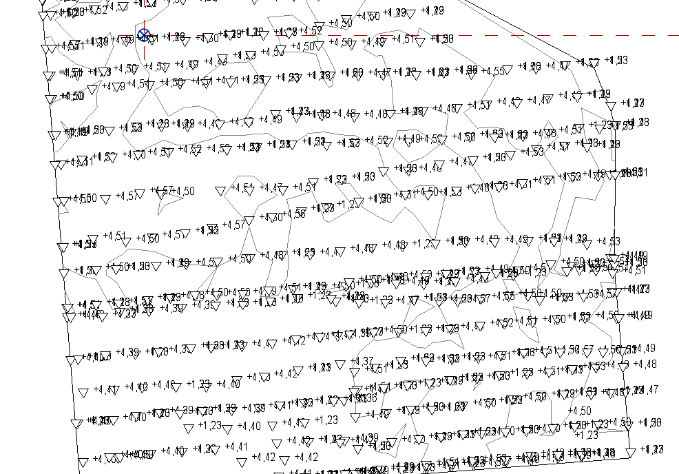
But this is not the final solution, because there is still an problem/fault in the script.
There are several points on top of each other
Elevation.dyn (43.5 KB)
You can see it in the screenshot. We don´t know how to solve it. Can someone help? I also have added the skipt.
There is only one terrain model in the Revit file.