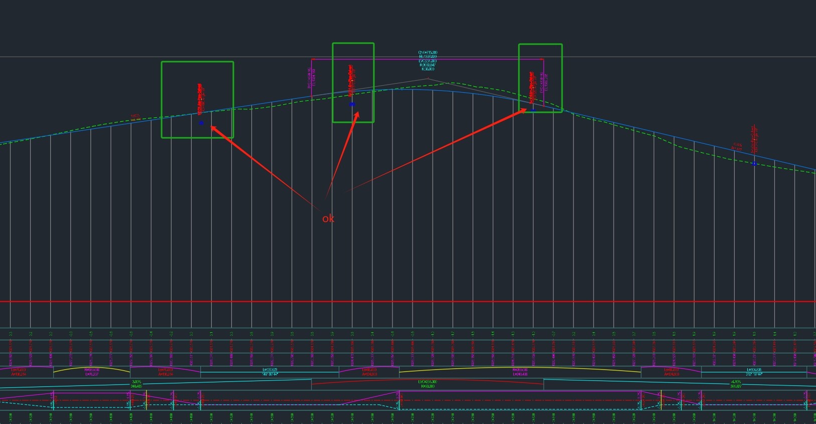
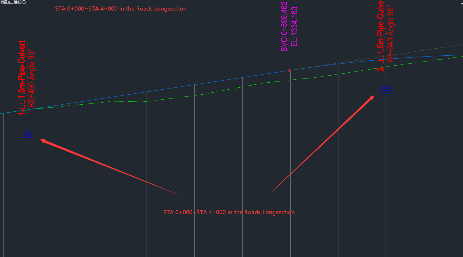
I added custom station elevation labels to the route station STA 0+000~STA 4+000 in the Roads Longsection dwg, and everything displayed normally.
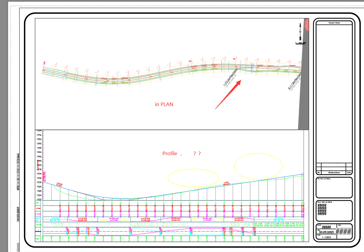
However, after executing the Create Sheets Wizard, multiple longitudinal section drawings were generated (STA 0+000~STA 0+700, STA 0+000~STA 1+400, STA 1+400~STA 2+100, …). All the custom station elevation labels added in STA 0+000~STA 4+000 Roads Longsection have now disappeared and are not displaying.
Where is the problem?
How can we avoid such mistakes?
Is this a basic Civil 3D thing or am I not seeing the tie into Dynamo?
If just Civil 3D best to move to that forum. If Dynamo can you outline where you are using it?
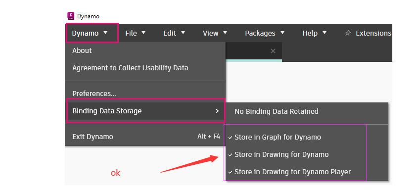
Yes. All of the options are enabled .
You may want to try disabling them if you want Dynamo to “forget” about the labels it created during the last run. Otherwise, it will track and update the objects when you change something in the graph rather than creating new labels every time the graph is executed.
My operation steps
1,Use C3D to create a Profile view (Roads Longsection) from STA 0+000 to STA 4+000.
2,Use Dynamo to create station elevation labels (ProfileViewStationElevationLabel.ByStationElevation), and all station elevation labels in the Profile view of the STA 0+000 to STA 4+000 road are displayed.
3,Use C3D to run the Create View Frames Wizard (for STA 0+000 to STA 2+000).
Use C3D to run the Create Sheets Wizard (for STA 0+000 to STA 2+000).
4,Generate plan and profile drawings for STA 0+000 to STA 0+700, STA 0+700 to STA 1+400, and STA 1+400 to STA 2+000.
Now, all the station elevation labels in the STA 0+000 to STA 0+700, STA 0+700 to STA 1+400, and STA 1+400 to STA 2+000. have disappeared and are not displaying.
5,The elevation labels of station numbers are displayed in the longitudinal section diagram of the road from STA 0+000 to STA 4+000.
Does the same thing happen if you don’t use Dynamo to create the labels?
Currently, C3D cannot batch annotate culvert information, so I can only use Dynamo for this task. However, this leads to a contradiction: all culvert information annotated with Dynamo will be lost after executing the Create Sheets Wizard.
If I don’t use Dynamo to create labels, I won’t be able to add annotations for culvert information in the longitudinal section drawing. After using the “Create Drawing Wizard”, these labels for culvert information created with Dynamo will disappear and not be displayed in the newly generated “Plan and Profile” DWG.
The dyn and DWG files have been updated. I’m using Dynamo to annotate culvert information on both the plan and Profile drawings by reading data from a CSV file.