Good day
Many of our surveyors uses a program Modelmaker to post-process their survey info. The processed info is then written out in a .tot file format. I want to write a script allowing us to easily import this information into Civil 3D as a surface.
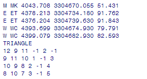
This system uses a fixed column layout for the point data, which is followed by a list of the triangles joining the points. The format of the file is as follows.

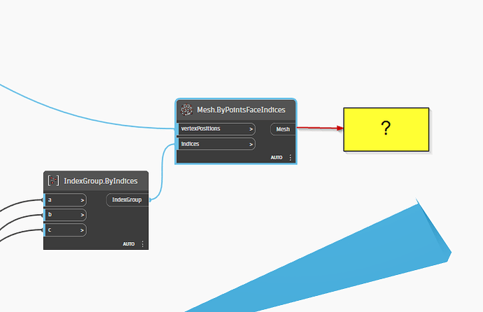
I managed to split the point and triangle info and create a mesh using the triangle instances.
but now I need to convert the mesh into a tin surface to use in Civil3D, it feels like there should be a node to convert a mesh to a tin, but I can’t find one…does anybody have suggestions on a workaround
or a node that I am missing?
Modelmaker.dyn (91.4 KB)
Modelmaker test.txt (266 Bytes)
From split the point create tin surface no need mesh
1 Like
Points → cogo points → tin surface is the workflow I am familiar with.
1 Like
Thanks for the replies, but I would like to keep the triangulation created by the surveyor. When I create a surface from points, a new triangulation is created that does not adhere to the break lines added by the surveyor.
An alternative might be to add the triangles as break lines to the surface created from points, but from this post - TinSurface from 3D Faces - Civil3D - Dynamo (dynamobim.com) it seems like this will make the script heavy… but if that is the only way… then that is the way I will follow.
There is a means of adding a line to a surface, but I am not sure if it would work. Would need a small (50 points) data set to work with, a dwg to pack it in, and your code to this point.
Even if it’s fun to fix stuff with Dynamo, why not use Civil 3D function as they is?
Can’t the surveyors deliver a dwg with 3D faces and then you can add them to a surface as objects. After that you delete them, and you will have a static surface with the same triangulation.
Hi Jacob
Thanks for the willingness to assist, I got a small sample that I intended to share, but as I tested it -I found the triangulation still needs some work - so working version of the code (at least up to the mesh creation) is under development again.
Hi Patrick
Yes, we usually request a landXML version of the surface data from the surveyor. But would be nice to be able to continue with information provided while waiting for the update. I am here is South-Africa, and many consultants use a program called model maker that works with tot files, so the surveyors just assume we can use a tot files. They usually provide a dwg with contours… but I feel like triangles are more accurate.
When reaching out some other people in our business, they indicated that the South-African country kit actually has the capability to import tot files…So my plan is to install that and see if I can use the build-in Autodesk tools before work further on the script - will keep you up to date.
2 Likes
Agree on that, with the triangles we can require C3D to maintain edges which I don’t think can’t be done with contours. With drawing object we can remove the dependencies to LandXML’s because we can delete the drawing objects from the file after that them has been added to the surface.

1 Like


